Detailed Trail Segment Information
Thank you so much for being a part of the Tahoe Rim Trail community!
Interested in our guided hikes and skills courses? Click here.
Be safe and go adventure!
Thank you so much for being a part of the Tahoe Rim Trail community!
Interested in our guided hikes and skills courses? Click here.
Be safe and go adventure!

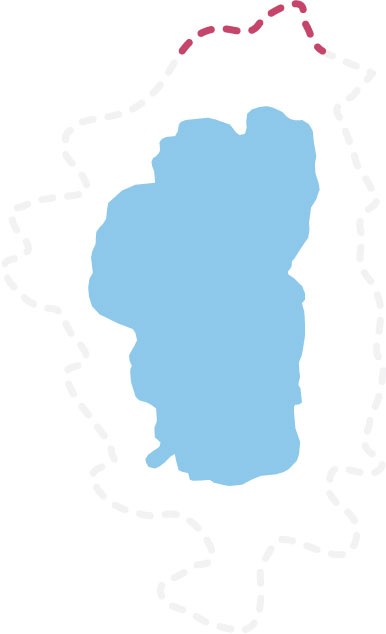 20.2 Miles
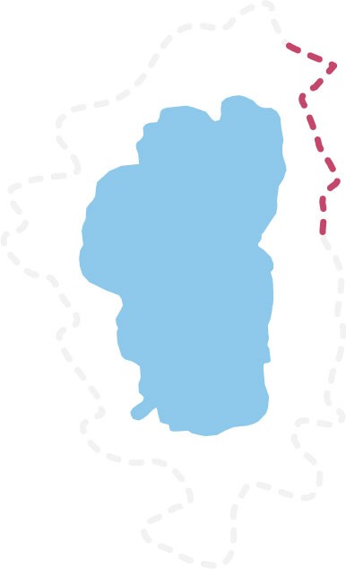

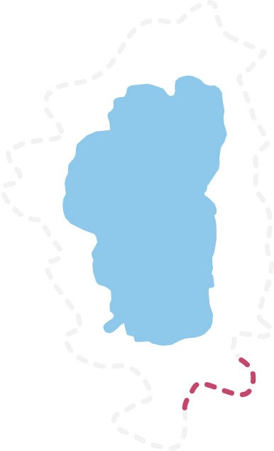 22.9 Miles


The files below provide waypoints and/or tracks that represent the trails making up the Tahoe Rim Trail system. Use these files to plan your trip and help with navigation in the field, but remember that they are not a substitute for carrying a map and a compass and knowing how to use them.
If the links below do not download with a single click, please right click and select “Open link in new window” to begin the download.
This file is suitable for use with many handheld GPS devices and some desktop mapping applications like Garmin’s Basecamp or Gaia GPS.
This file is suitable for many handheld GPS devices that require fewer points per track, such as Delorme (Garmin) InReach devices.
This file is suitable for use with Google Earth and some desktop mapping applications.
This shapefile is suitable for use with ArcMap and other desktop GIS mapping applications.
Having issues with these files? Please contact us at info@tahoerimtrail.org.
Post with #tahoerimtrail and we'll share our favorites!
This site is protected by reCAPTCHA and the Google Privacy Policy and Terms of Service apply.
Crew Leaders | Guides | Board
 Early Bird Bonus!
Sign up for Raise the Rim as a multi-use participant before August 1 and you’ll be entered to win a 2-pack of Northstar Bike Haul tickets!
Hit the trail, log your miles, and ride into August with a chance to win. Don’t wait—[register now]!

![🌲 Explore Tahoe’s High-Elevation Forests on a Whitebark Pine Hike!
Join the Tahoe Rim Trail Association and the Sugar Pine Foundation for a guided hike through the stunning subalpine landscape near Barker Pass. Along this moderate 3-mile roundtrip trek, naturalist Sarah Green will introduce you to the resilient whitebark pine—an essential species fighting for survival in a changing climate. Learn how this iconic tree shapes mountain ecosystems, why it's federally listed as threatened, and what’s being done locally to protect it.
Don’t miss this opportunity to take in sweeping views of Lake Tahoe, connect with local experts, and discover how you can help safeguard our forests for the future.
🗓️ When: 9:00 AM – 12:00 PM
📍 Where: Barker Pass Trailhead
👟 Difficulty: Moderate
Sign up today! 👉️ [LINK IN BIO]](https://scontent-tpe1-1.cdninstagram.com/v/t51.82787-15/514712138_18468744070076686_3870721153907695804_n.jpg?stp=dst-jpg_e35_tt6&_nc_cat=107&ccb=1-7&_nc_sid=18de74&_nc_ohc=q1n7z9a4qtIQ7kNvwGFgzoL&_nc_oc=Adm7Dzc8szsmQd_qfgaSTFNWJh-2bhSvp0lSTNXde8bVdNx1P8bOGywHB6O2ia709UY&_nc_zt=23&_nc_ht=scontent-tpe1-1.cdninstagram.com&edm=AM6HXa8EAAAA&_nc_gid=NxlCOz9Tc8X7Ao9-T8K6HQ&oh=00_AfRuycRQH3cocY0og1YHwMQKPVyuFnBzaJ-desRqqQxrqQ&oe=686F66E7)

![🚨 GIVEAWAY ALERT! 🚨
Love dirt, speed, and epic views? Sign up for Raise the Rim as a multi-use participant before August 1 and you'll be entered to win a 2-pack of @northstar_california Bike Haul tickets! 🎟️🚵♀️
Ride lift-serviced trails, carve downhill lines, and experience one of Tahoe’s top bike parks—on us. 🏞️
Sign up today, log your miles this August, and you could be hitting the trails at Northstar for free.
👉 [LINK IN BIO] to register and ride!
#RaiseTheRim #NorthstarBikePark #TahoeRimTrail #MountainBikingTahoe #TrailChallenge](https://scontent-tpe1-1.cdninstagram.com/v/t51.82787-15/514082730_18468461347076686_8482344228852513860_n.jpg?stp=dst-jpg_e35_tt6&_nc_cat=108&ccb=1-7&_nc_sid=18de74&_nc_ohc=M4ZJwCMf6DIQ7kNvwE4IXuQ&_nc_oc=AdlzNF7rEhLeHsHSd1GJrPEZ1whe8oeekFAWFbFQbTodc12ihiPYE_DjFvNCzr_eBXk&_nc_zt=23&_nc_ht=scontent-tpe1-1.cdninstagram.com&edm=AM6HXa8EAAAA&_nc_gid=NxlCOz9Tc8X7Ao9-T8K6HQ&oh=00_AfT_3_tG4iTvw8po05GNq2XNyp96nK4G31ODplNydyoBEw&oe=686F49FC)
![🎉 Registration is officially OPEN for Raise the Rim 2025! 🎉
Every mile you hike, bike, or walk in August helps protect the Tahoe Rim Trail for generations to come. Sign up, set your goal, and start rallying your crew to support the trail you love.
💥 Raise $50 and you'll get our exclusive 2025 Raise the Rim shirt + a ticket to celebrate with us at the Raise the Rim Afterparty on Sunday, September 7 from 1–4 PM at Tipsy Putt in South Lake Tahoe!
Let’s make every mile count.
➡️ [LINK IN BIO] to register now.
#RaiseTheRim #TahoeRimTrail #FundraiseOutside #EveryMileMatters #HikeForACause
](https://scontent-tpe1-1.cdninstagram.com/v/t51.82787-15/514001891_18468426706076686_713107471684733342_n.jpg?stp=dst-jpg_e35_tt6&_nc_cat=100&ccb=1-7&_nc_sid=18de74&_nc_ohc=rUlP5jyXNPYQ7kNvwFbidds&_nc_oc=AdnKm9Nt-yNJ3dHGnUHhN9Q4b9RHF96HFrLVFhZxfBeWt329J5fLvRc6P9bgc88ewZc&_nc_zt=23&_nc_ht=scontent-tpe1-1.cdninstagram.com&edm=AM6HXa8EAAAA&_nc_gid=NxlCOz9Tc8X7Ao9-T8K6HQ&oh=00_AfQ_IsNuVzkljIMQD7kwA6BZqfac2umrgE7AWV5ysFU5Wg&oe=686F5011)


![🚨 Trail update: Only a few steps away from being full! 🥾
Our first Guided Thru-Hike of the season (August 2–16) has just 5 spots left — and our second, (August 16–30) is almost completely sold out, with just 1 spot remaining!
If hiking all 170+ miles of the Tahoe Rim Trail with expert guides, campsite support, and new trail friends sounds like your kind of summer, don’t wait — grab your spot before they’re gone! ⏳🌲
🔗 Learn more & register: [Link in Bio]
#TahoeRimTrail #ThruHikeTahoe #GuidedAdventure #BackpackingGoals](https://scontent-tpe1-1.cdninstagram.com/v/t51.75761-15/508592592_18466084108076686_3719517701156797260_n.jpg?stp=dst-jpg_e35_tt6&_nc_cat=109&ccb=1-7&_nc_sid=18de74&_nc_ohc=ZUbyENRIfnAQ7kNvwHzCg8f&_nc_oc=AdnBGMPr9wHzV6GwYmI1XVMq3G_MwLQWSccsZjiMGQ0pfrRVDMEfWMpkfYSCEud_Zxs&_nc_zt=23&_nc_ht=scontent-tpe1-1.cdninstagram.com&edm=AM6HXa8EAAAA&_nc_gid=NxlCOz9Tc8X7Ao9-T8K6HQ&oh=00_AfTebSSEDbwD6-iV2BrWRi8Iidp6XmmBfOs0bD1YQvh32Q&oe=686F3B76)

